Spatial Modeling of Desertification Sensitivity Using Multiple Environmental Indicators: A MEDALUS-Based Approach in Umm Aqheqih, Eastern Libya
DOI:
https://doi.org/10.63318/waujpasv4i2_70Keywords:
Desertification sensitivity, Environmental Sensitivity Area Index (ESAI), MEDALUS, Spatial modeling, Land degradationAbstract
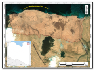
Desertification represents a major environmental challenge in arid and semi-arid regions, where land degradation processes threaten ecosystem stability and sustainable development. This study aims to assess land sensitivity to desertification in the Umm Qahqih area, eastern Libya, using a modified multi-variable Environmental Sensitivity Area Index (ESAI). The study area covers approximately 620 ha, with elevations ranging from 17 to 35 m above sea level. Field investigations were conducted based on 12 representative land units, from which detailed soil profiles and composite samples were collected at variable depths exceeding 90 cm. Soil physical and chemical properties were analyzed, and statistical analyses were conducted to evaluate relationships between selected physicochemical properties and degradation indicators. Significant associations were observed among soil degradation indices, indicating strong physicochemical interactions within the soil system. A spatially explicit desertification sensitivity map was generated using Surfer software. The results revealed pronounced spatial heterogeneity in land sensitivity across the study area, with a mean ESAI value of 1.17 and values ranging from 0.67 to 1.66. Two land units were classified as highly critical (C3), requiring immediate intervention, while 28.9% of the assessed land units were classified within the critical sensitivity classes (C1, C2, and C3), indicating substantial environmental vulnerability. Other critical and fragile units reflected varying degrees of degradation driven by localized soil, vegetation, climatic, and human-induced factors. Non-affected areas were mainly associated with more favorable soil conditions and lower anthropogenic pressure. The findings demonstrate the effectiveness of the modified ESAI model as a flexible and robust tool for identifying priority areas for desertification control. The generated sensitivity map provides a scientific basis for spatially targeted land management strategies and supports decision-making aimed at mitigating land degradation and promoting sustainable land use in eastern Libya.
Downloads
Downloads
Published
Issue
Section
License
Copyright (c) 2026 The authors

This work is licensed under a Creative Commons Attribution-NonCommercial 4.0 International License.
This journal uses Creative Commons Attribution-Noncommerical 4.0 International License (CC BY-NC 4.0), which permits use, sharing, adaptation, distribution and reproduction in any medium or format, as long as you give appropriate credit to the original author(s) and the source, provide a link to the Creative Commons license, and indicate if changes were made. To view a copy of this license, visit https://creativecommons.org/licenses/by-nc/4.0/.
Copyright of articles
Authors retain copyright of their articles published in this journal.